Calgary - Chinatown

26841758811_074bed8420_k.jpg

How to Get There:

An easy walk just north of Downtown, the Chinatown neighborhood lies on the south side of the Bow River at the foot of the Centre Street bridge.

Both the Blue and Red CTrain lines and many Bus Rapid Transit and regular buses run nearby on the 7th Street corridor, just 3 blocks south.

A Brief History:

The permanent Chinese settlement in Calgary happened because of a double-cross.

Like in the United States, the Dominon’s transcontinental railroad project suffered in part for lack of skilled workers, willing to endure the harsh climate, strenuous labor, and isolation from the rest of society. These were jobs that the majority of white Europeans who’d settled in the east did not want to do, regardless of the salary. And the solution the Canadian Pacific Railway found, much like the Western Pacific Railway in California, was to import labor from South China and pay them cheaply (for North America). As the C.P.R. was also a steamship company with routes to Asia, transit was quickly arranged, with the Canadian government guaranteeing return fare to China when the rail tracks were completed.

However, once the line was finished in 1885, the government refused to pay for the workers’ return trip, and imposed a severe head tax on new Chinese immigration, trapping the laborers in Canada and unable to bring their families. So the double-crossed workers settled on the east side of the city – and then were kicked out by fire and, ironically, railroad expansion – finally taking root on the north side of downtown by 1910, when Chinese merchants and mutual-aid societies acquired adjacent properties (in much the same fashion as what happened in Chicago).

Growth was slow due to the government’s deliberately racist Chinese Exclusion Act of 1923, which was not revoked (again like the U.S.) until 1947. While Calgary did see marked growth in its Asian population after World War II, like many other cities, the newcomers were just as likely to settle in the suburbs, and little development took place in the historic neighborhood.

In the 1970s a proposal to run a freeway extension to downtown put Chinatown squarely in the crosshairs, and this was the catalyst for Calgary’s Chinese community to build political representation and economic development. The proposal was defeated (but spurred planning for today’s metro-wide network of light-rail and bus rapid transit routes) and the residents, associations, and businesses of Chinatown finally developed its own Development Task Force.

By the 1980s this group had steered development of new housing, schools, retail and office space, and the Chinese Cultural Centre, ensuring its survival for another generation.

Image by Antoine 49 via Flickr, CC 2.0 license

Image by Antoine 49 via Flickr, CC 2.0 license

Alberta fared better than most places in the economic troubles of the 2000s but this good fortune means that property values in Calgary’s core have soared and this has led to pressure for redevelopment in Chinatown, with new restaurants, retail, and housing coming on line recently. The neighborhood’s master plan has yet to be updated (with lots of planning to plan but no action yet), but property developers have already started asking for substantial variances to increase density and commercial space.

Will Calgary’s Chinatown find a pathway in time to renewal and economic vitality without losing its cultural uniqueness and heritage? Or will it be consumed by copies of mixed-use high rises that look the same as buildings in Toronto and Vancouver?

Image by Greenwood714 via Wikimedia Commons, CC 3.0 license

Image by Greenwood714 via Wikimedia Commons, CC 3.0 license

What to See and Do:

The neighborhood’s compact size and easy access to transit makes for a great single-day exploration! Sites to check out include:

The Calgary Chinese Cultural Centre, at the intersection of 2nd Ave SW at 1st St SW, maintains a busy schedule of events and houses a museum in its basement with replicas of many Chinese artifacts, including furniture, tapestries, pottery, and Terracotta Warriors. Above, the Dr. Henry Fok Cultural Hall rises 70 feet and is carved and painted to resemble the Temple of Heaven in Beijing – a can’t miss, eminently Instagrammable sight.

Image by Bernard Spragg. NZ via Flickr, Public Domain

Image by Bernard Spragg. NZ via Flickr, Public Domain

Just north of the Cultural Centre and running along the riverfront is Sien Lok Park, which not only has walking paths (that continue in either direction as RiverWalk Calgary) but also is guarded by two white Chinese lions on its western end! Inside are two large stone carvings which commemorates the early Chinese gold miners and railroad workers of the 1850s-1860s. At the eastern end of the park at the Centre Street bridge, note the English lion motif.

The Centre Street – 3rd Avenue intersection is the heart of Chinatown, with all four corners featuring small shops and restaurants. The two-story red brick building just further up on the northeast side dates from 1905, and Sun Yat-Sen had given a speech there.

Image by Can Pac Swire via Flickr, CC 2.0 license

Image by Can Pac Swire via Flickr, CC 2.0 license

On the northeast side of Centre and 4thAvenue is the Dragon City Mall, which houses more Asian clothing and jewelry shops, anime-goods stores, travel agents, and several restaurants.

Walk around to 1st Street SE and head back north to the river to complete the loop around Chinatown and see more small businesses and residential towers.

Image by Jon Lin Photography via Flickr, CC 2.0 license

Image by Jon Lin Photography via Flickr, CC 2.0 license

Along the river, every August, the Calgary Dragon Boat Society puts on races and a big family-friendly festival (with free admission). In the summertime, keep your eyes open for practice sessions!

Where Family Travelers Can Stay:

The neighborhood is bookended by several major hotels:

  • Delta Hotels Calgary Downtown
  • The Westin Calgary
  • International Hotel Calgary
  • Sheraton Suites Calgary Eau Claire
Image by en:User:Drhaggis via Wikimedia Commons, CC 3.0 license

Image by en:User:Drhaggis via Wikimedia Commons, CC 3.0 license

What other Family Travel attractions are nearby?

The Calgary Tower is only a few blocks south on Centre Street at 9th Avenue, and boasts the highest 360-degree observation deck in the world.

Across the street (1st St SE at 9th Ave SE) is the Glenbow Museum, featuring local fine art and culture as well as exhibitions of world artworks.

The Devonian Gardens in the CORE shopping center, at 7th Avenue SW @ 2nd Street SW, offer tropical palms and plants, with fish ponds and a children's play area.

Image by kristina via Flickr, CC 2.0 license

Image by kristina via Flickr, CC 2.0 license

The Calgary Zoo is not within walking distance, but is an easy bus ride from downtown, and it has panda bears on loan from China for several more years! It also has extensive botanical gardens, exhibits on the Canadian wilds, and even a dinosaur park.

Just north of the zoo is the TELUS Spark science museum, equipped with a planetarium and lots of hands-on exhibits to appeal to both kids and parents.

See also:

Our Family Travel Airport Guide to Calgary International Airport

http://www.chinatowncalgary.com/

http://www.avenuecalgary.com/City-Life/Neighbourhoods/Where-to-Eat-and-Shop-in-Chinatown/

http://dailyhive.com/calgary/history-chinatown-calgary

https://getinspiredeveryday.com/adventure/chinatown-in-calgary/

Header image of interior, Dr. Henry Fok Cultural Hall, by Reg Tiangha via Flickr, CC 2.0 license

New York City - Brooklyn

Normal.dotm
0
0
1
16
94
Northdale Middle School
1
1
115
12.0


0
false


18 pt
18 pt
0
0

false
false
false


 /* Style Definitions */
table.MsoNormalTable
	{mso-style-name:"Table Normal";
	mso-tstyle-rowband-size:0;
	mso…

“Moon Festival” by Joe Mazzola via Flickr, CC 2.0 license

How to get there:

Brooklyn holds amazing ethnic and religious diversity in its vast area, not just across the borough, but also within each of its dozens of neighborhoods. This is great for artistic, cultural, and economic development – but also makes it confusing for a visitor to stop in one place and try to get a complete picture.

Nine neighborhoods in the southwest corner of Brooklyn are experiencing the strongest growth in Asian population, but to narrow it down for travelers, the main concentrations are in Sunset Park along the 8th Avenue corridor, Bensonhurst along 86th Street, Marine Park in the Sheepshead Bay Road stretch, and Sheepshead Bay in the eastern end of Avenue U.

Click for full MTA subway map

Click for full MTA subway map

MTA stations and trains that put travelers in easy walking range of these four corridors are:

8th Avenue – served by the N, Q, and W

in Bensonhurst, the 18th Avenue, 20th Avenue, and Bay Parkway stops – served by the D

Sheepshead Bay Road – served by the B and Q

Avenue U – served by the Q and the B3 bus line

Depending on the length of your stay, a multi-ride MetroCard from the MTA can represent a great bargain, and makes New York City very easy to get around.

Manhattan’s Chinatown links directly with Brooklyn’s – the Canal Street station serves both the N and the Q, and the Grand Street station serves the B and the D trains.

Click to open Google Maps

Click to open Google Maps

Normal.dotm
0
0
1
19
109
Northdale Middle School
1
1
133
12.0


0
false


18 pt
18 pt
0
0

false
false
false


 /* Style Definitions */
table.MsoNormalTable
	{mso-style-name:"Table Normal";
	mso-tstyle-rowband-size:0;
	ms…

Click to open the fascinating University of Virginia Cooper Center Map Project to visualize ethnic patterns from the 2010 Census. 

A brief history:

When New York City’s renaissance finally happened in the Clinton years, Manhattan’s rents increased radically without a corresponding increase in the stock of housing and commercial space. Residents of Chinatown and newcomers from East Asia figured out that Brooklyn’s real estate (in the 1990s and 2000s) was a comparative bargain, and the 20-30 minute train ride meant they didn’t have to give up ties with the original neighborhood and the Financial District.

Much as migrants from Taiwan and Northern China decided to settle in Queens where the Mandarin dialect was common, instead of Manhattan’s Cantonese-dialect dominance, immigrants from Eastern China’s Fuzhou Province and nearby areas (speaking Hakka, Wenzhounese, Fujianese, and Shanghainese dialects) in the 2000s also bypassed Manhattan. Sunset Park is sometimes called “Little Fuzhou” in reference to this.

Normal.dotm
0
0
1
8
47
Northdale Middle School
1
1
57
12.0


0
false


18 pt
18 pt
0
0

false
false
false


 /* Style Definitions */
table.MsoNormalTable
	{mso-style-name:"Table Normal";
	mso-tstyle-rowband-size:0;
	mso-t…

Image by Bcaspirit via Wikimedia Commons, CC 3.0 license

But also, Cantonese-speakers continue to arrive; some spurred on by the increasing Mainland domination of Hong Kong, others seeking security and education for their children, and others to park their money in America. They too have done the math and determined that Brooklyn is a good place; some Cantonese-influenced areas are now known as “Little Hong Kong”. Overall, the foreign-born Chinese population in Brooklyn increased from 86,000 in 2000 to 128,000 in 2013.

Normal.dotm
0
0
1
14
85
Northdale Middle School
1
1
104
12.0


0
false


18 pt
18 pt
0
0

false
false
false


 /* Style Definitions */
table.MsoNormalTable
	{mso-style-name:"Table Normal";
	mso-tstyle-rowband-size:0;
	mso…

Image by Mark Chang via Flickr, CC 2.0 license

What to see and do:

Despite the impressive population and business growth, the Brooklyn Chinese neighborhoods are still building up; there are still significant Russian, Jewish, African-American, and Hispanic elements interspersed – and it really wouldn’t be New York City without them; the diverse mix and unexpected mashups of culture are what make NYC and America truly great.

But, with development spread out over so many miles, the critical mass has not yet been achieved to have significant shopping malls or temples built that would be a natural draw for cultural tourism.

Normal.dotm
0
0
1
18
104
Northdale Middle School
1
1
127
12.0


0
false


18 pt
18 pt
0
0

false
false
false


 /* Style Definitions */
table.MsoNormalTable
	{mso-style-name:"Table Normal";
	mso-tstyle-rowband-size:0;
	ms…

Image by MusikAnimal via Wikimedia Commons, CC 4.0 license

So, in the 2010s, the best place to get the “Brooklyn Chinatown” experience is on 8th Avenue. 8 is a lucky number in Asian cultures, and “8th Avenue” can be translated to “Road to Prosperity.” The MTA stop is open-air but below street level, and the bulk of Chinese businesses are between 6 blocks south and 20 blocks north of the station (62nd Street).

For several years there has been talk and tentative financing, but apparently no authorization, for a traditional Chinese entrance archway to be built over 8th Ave. between 64th-65th Streets. (Or perhaps 60th-61st.) If the arch is ever built, that would be the natural photo opportunity – however – for now the six blocks north of the train station hold the strongest concentration of small shops, cafes, and everyday service businesses for the local Chinese community. The low two- and three-story buildings give the neighborhood plenty of sun, and wide sidewalks are pleasant for a walk with the family.

Normal.dotm
0
0
1
8
48
Northdale Middle School
1
1
58
12.0


0
false


18 pt
18 pt
0
0

false
false
false


 /* Style Definitions */
table.MsoNormalTable
	{mso-style-name:"Table Normal";
	mso-tstyle-rowband-size:0;
	mso-t…

Image by Jchan84442 via Wikimedia Commons, CC 4.0 license

If it’s a small-town getaway you’re looking for after spending time among the skyscrapers of Manhattan, this is the place to go for an hour’s stroll, a nosh at a café and some picnic shopping before heading onward to other attractions in Brooklyn.

Where family travelers can stay:

Near the Union Street station, serving the N, R, W, and D lines, are the Holiday Inn Express-Brooklyn, Fairfield Inn & Suites by Marriott Brooklyn, and the Union Hotel.

Near the 36th Street station, serving the N, Q, R, W, and D lines, is the Wyndham Garden Brooklyn Sunset Park hotel.

In Bay Ridge, the Best Western Gregory Hotel on 4th Avenue is within walking distance of the 86th Street station on the R train.

In the Marine Park / Sheepshead Bay area, the Best Western Plus Brooklyn Bay Hotel and Comfort Inn are both conveniently located on Emmons Avenue, with access to the B and Q trains.

What other family travel attractions are nearby?

Normal.dotm
0
0
1
15
86
Northdale Middle School
1
1
105
12.0


0
false


18 pt
18 pt
0
0

false
false
false


 /* Style Definitions */
table.MsoNormalTable
	{mso-style-name:"Table Normal";
	mso-tstyle-rowband-size:0;
	mso…

Image by acidpolly via Flickr, CC 2.0 license  

Coney Island (with easy access on the F and Q lines) has been a classic family getaway for New Yorkers for generations – the Boardwalk, Luna Park, and Steeplechase Park are iconic attractions, and the NY Aquarium is also steps away.

Normal.dotm
0
0
1
15
90
Northdale Middle School
1
1
110
12.0


0
false


18 pt
18 pt
0
0

false
false
false


 /* Style Definitions */
table.MsoNormalTable
	{mso-style-name:"Table Normal";
	mso-tstyle-rowband-size:0;
	mso…

Image by gigi_nyc via Flickr, CC 2.0 license    

Floyd Bennett Field (Q35 bus from the Brooklyn College/Flatbush Ave station on the 2 and 5 lines) is a long-abandoned airport that has been converted into sports, arts, and nature uses and is part of the Gateway National Recreation Area.

Normal.dotm
0
0
1
14
82
Northdale Middle School
1
1
100
12.0


0
false


18 pt
18 pt
0
0

false
false
false


 /* Style Definitions */
table.MsoNormalTable
	{mso-style-name:"Table Normal";
	mso-tstyle-rowband-size:0;
	mso…

Image by Eli Mergel via Flickr, CC 2.0 license

Prospect Park (15th Street-Prospect Park station on the F and G lines for the west side; Prospect Park station on the B, Q, and S lines for the east side) is Brooklyn’s largest tract of parkland, with miles and miles of hiking trails around hills and lakes, programs for kids at the Audubon Center, skating and boating at the LeFrak Center, and includes attractions such as the Japanese Hill-and-Pond Garden, (part of the broader Brooklyn Botanic Garden), and the Prospect Park Zoo.

And of course, easy subway access makes all of Lower Manhattan’s attractions convenient to visit.

See also:

Our Pinterest folder for New York City

And other interesting resources can be found at:

en.wikipedia.org/wiki/Chinatowns_in_Brooklyn

http://www.nytimes.com/2015/04/16/nyregion/influx-of-chinese-immigrants-is-reshaping-large-parts-of-brooklyn.html?_r=0

http://www.nydailynews.com/changing-chinatowns-move-manhattan-sunset-park-home-chinese-nyc-article-1.948028

http://www.borrowedculture.com/2011/05/10/brooklyn-8th-avenue-chinatown/

New York City - Flushing

How to get there:

The 7 subway is the easiest way to reach downtown Flushing, as the line terminates right in the middle of the shopping district. The Long Island Rail Road is another option for travelers coming from Manhattan’s Penn Station; the LIRR station literally empties onto Main Street.

Click to open the full MTA subway map

Click to open the full MTA subway map

From LaGuardia Airport, the Q48 local bus also routes directly into downtown Flushing.

Depending on the length of your stay, a multi-ride MetroCard from the MTA can represent a great bargain, and makes New York City very easy to get around.

Click to open in Google Maps

Click to open in Google Maps

Normal.dotm
0
0
1
19
109
Northdale Middle School
1
1
133
12.0


0
false


18 pt
18 pt
0
0

false
false
false


 /* Style Definitions */
table.MsoNormalTable
	{mso-style-name:"Table Normal";
	mso-tstyle-rowband-size:0;
	ms…

CLICK TO OPEN THE FASCINATING UNIVERSITY OF VIRGINIA COOPER CENTER MAP PROJECT TO VISUALIZE ETHNIC PATTERNS FROM THE 2010 CENSUS.

A brief history:

The economic malaise of the 1970s hit New York City particularly hard. As factories left for southern states and corporate headquarters followed, jobs disappeared for the poor, middle-class, and upper class all at the same time. As workers started leaving the city to try to find employment elsewhere, the first big wave of retirees started moving away to the Sunbelt. These two outbound migrations brought property values down across the city – remember, at this time even Manhattan still had block after block of abandoned tenements and warehouses.

Flushing, the community on the eastern border of Queens borough and prime example of a commuter suburb, was triply affected because of its proximity to LaGuardia and Kennedy Airports: those jobs also saw sustained cuts in the late 70s and early 80s. The Greek and Italian families who had built the town could no longer afford to stay, or wanted to leave for warmer weather – and they left, regardless of the price they could get.

The people who stayed were the nucleus of a small Japanese community and a few Chinese who had sought a better place to live than the overcrowded, crime-infested Chinatown in Manhattan. These were also Mandarin-speakers, a minority in the largely Cantonese enclave in the City.

By the late 1970s, Taiwan’s economy and civil society had started its recovery, and thousands emigrated to America for even more freedom and opportunity. These people were native Mandarin-speakers and also quite comfortable dealing with Japanese – and they found Flushing quite hospitable.  As these newcomers told their families and friends and business associates about the pleasant setting and bargain property prices, the population boomed: by the mid-1980s Flushing was called “Little Taipei”.

With the proliferation of Mandarin-speakers and the shops and businesses they started in the 1980s, Chinese from other northern provinces, newly able to leave the People’s Republic, were attracted to Flushing, too. Even a sizeable Korean population found its way there (although its ongoing development would lead to “Long Island Koreatown” taking shape along Northern Boulevard just to the east of Flushing’s downtown.)

By the time of the economic boom of the Clinton years of the 1990s, then, Flushing was very well-positioned with convenient airport and ocean access for international trade, strong banking connections, a well-educated workforce, and prime position on key commuter rail lines into Manhattan’s heart. In-migration has continued, adding Southeast Asian and South Asian/Subcontinent ties and flavors to the dynamic mix. Walking up out of the subway station, on a summer’s day, you will feel as if you’ve been teleported into an Asian city – but make no mistake, there’s nowhere else this could have happened but in America!

What to see and do:

Downtown Flushing is compact- from the subway station or LIRR stop, all the key attractions and hotels (below) are within a quarter-mile radius. But, your family can easily spend a half-day or more wandering the neighborhood. Just keep an empty stomach before arriving!

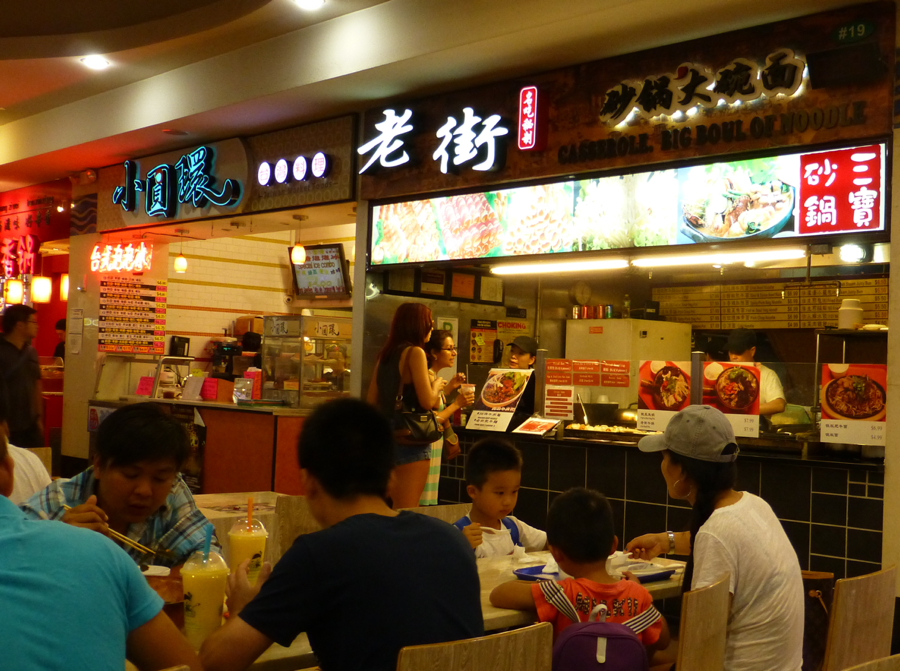
The intersection of Main Street and Roosevelt Avenue is where transit drops a traveler off and it is the pulsing heart of downtown.  Most of the southeast block is taken up by the New World Mall, a three-story shopping center with clothing, electronics, children’s gear, cosmetics and beauty, media, and jewelry stores. Its lower-level food court is legendary: over 30 shops with specialties from across Asia, including several franchisees of chains from Taiwan. There’s also a Macy’s just to the east, and a J-Mart full-sized supermarket tied into the mall.

Walking south along Main and under the LIRR tracks, Kissena Boulevard splits off at an angle to frame the modern architecture of the Queens Public Library, notable for its international language collections – over 15 languages are supported with current periodicals, reference materials, and over 50,000 books!

Look for the giant red bowl above the "Red Bowl Noodle Shop" in the middle of the picture...

Look for the giant red bowl above the "Red Bowl Noodle Shop" in the middle of the picture...

Restaurants and karaoke joints, bakeries and banks line the street southbound for several blocks beyond the library before residential buildings become more common.

Heading west from the Main-Roosevelt intersection are more specialty shops, restaurants and KTVs, a block of housing towers, and then the massive Flushing Mall, where you’ll find a Target, Marshalls, and Best Buy; pretty standard suburban fare but there is a hotpot restaurant and an Asian grocery inside…

North of the Main-Roosevelt intersection is the St. George’s Episcopal Church, over 300 years old, and opposite it, Queens Crossing, the ‘upscale’ mall in Flushing with interior design and furniture stores, and a two-story food court / restaurant complex.

Two more blocks northbound are filled with still more local services and specialty stores, ending at the busy thoroughfare of Northern Boulevard and the transition into Long Island Koreatown.

East of the Main-Roosevelt intersection are even more shops and cafes, especially bubble tea places, and a Sanrio store that’s always fun with kids.

Eater NY has a brilliant interactive map of their recommended restaurants in Flushing, and here’s an article on About.com with recommendations dining and shopping.

Where family travelers can stay:

Several family-friendly hotels are located within blocks of downtown and the Metro station – and considering how close they are to LaGuardia Airport, these are also great alternatives to staying on Manhattan:

Best Western Queens Court Hotel

Sheraton LaGuardia East Hotel

Hyatt Place Flushing/LaGuardia Airport Hotel

The Parc Hotel

What other family travel attractions are nearby?

Image by jschauma via Flickr, CC 2.0 license

Image by jschauma via Flickr, CC 2.0 license

One stop east on the 7 or LIRR drops travelers off at the Mets-Willis Point station, entrance to Flushing Meadows Corona Park, home of the 1964 World’s Fair, and also the Queens Zoo, NY Hall of Sciences, and the Queens Museum for Visual Arts (where they have a model of every building in New York City!)

In season of course, the same train station serves Citi Field, home of the New York Mets and a fun ballpark to visit regardless of how well the team is playing…

A half-mile south on Main Street from downtown is the Queens Botanical Garden, which offers events and programs year-round.

And of course, between the 7 and the LIRR, all of Midtown Manhattan’s attractions are just a short ride away. Grand Central Station is worth a visit just to witness its stunning restoration, as well as to watch the steady flow of commuters (and eat at its excellent underground food court...)

See also:

Our Pinterest folder for New York City

And other interesting resources can be found at:

https://en.wikipedia.org/wiki/Chinatowns_in_Queens

http://nypost.com/2016/08/06/the-best-new-eateries-in-flushings-chinatown/

http://www.nycgo.com/articles/must-see-flushing-slideshow

http://freshnyc.com/blog/chinatown-new-york-city-manhattan-brooklyn-and-flushing-queens


New York City - Manhattan Chinatown

How to get there:

This neighborhood has been pushing its boundaries east and north in the 21st Century, but the traditional entrance is still a classic: the Canal Street subway station, served by the 6 (local and express), and the 4, J, R, and Z trains.

Other stations that put you inside or in easy walking range are Grand Street, on the B and D lines, and also the Bowery Station, served by the J and Z.

Click to open the full MTA subway map

Click to open the full MTA subway map

Depending on the length of your stay, a multi-ride MetroCard from the MTA can represent a great bargain, and makes New York City very easy to get around.

Click to open in Google Maps

Click to open in Google Maps

CLICK TO OPEN THE FASCINATING UNIVERSITY OF VIRGINIA COOPER CENTER MAP PROJECT TO VISUALIZE ETHNIC PATTERNS FROM THE 2010 CENSUS..

CLICK TO OPEN THE FASCINATING UNIVERSITY OF VIRGINIA COOPER CENTER MAP PROJECT TO VISUALIZE ETHNIC PATTERNS FROM THE 2010 CENSUS..

A brief history:

By the 1870s, declining job prospects in California (after the Gold Rush and railroad booms had faded) and growing anti-Chinese actions there pushed first-generation migrants ever eastward, first to Chicago and then to New York.

The southeast corner of Manhattan then was slum territory – overcrowded, under-policed, a waiting firetrap with cigar shops, garment factories, and warehouses willing to pay next-to-nothing to those desperate for work. Mott Street was where the newcomers first found places to stay, and stay they did. When the Chinese Exclusion Act was enacted in 1882, there were about 2,000 Chinese in the Lower East Side – that population tripled by 1900 but was almost entirely male, as women largely did not participate in the waves of emigration until after World War II.

Fierce anti-Asian bigotry from the other immigrant groups in New York hemmed the Chinese population into just a few ridiculously cramped city blocks, and coupled with the absence of women – and thus families – the men created tribal gangs to find work, look after each other, and claim scarce resources… which meant crime and violence were rampant in the ghetto. This situation held all the way up to the 1960s, when finally fresh immigration brought the gender ratio into something more balanced.

Even while Chinatown’s population was booming in the 1970s and 1980s, housing was still substandard and many buildings in the Bowery and Lower East Side were derelict. Drugs, street gangs, and violence were pervasive – this was not a neighborhood people wanted to visit, eat in, or live in – it was the embodiment of the stereotype of lawless New York City, notably filled with non-white criminals and poor, as seen in countless movies and TV shows of the era. New York’s renaissance had not yet begun.

Yet even in this bleak situation, Chinese kept moving in – instead of Cantonese groups who had been the mainstay of Chinatown from the 1880s onward, however, these were Fujianese, Taiwanese, and northern Mandarin-speakers. Reinvestment, residential rent controls, community-oriented policing, better economic conditions in general, and more trade with Asian countries all helped stabilize Chinatown as the 1990s started. As the city started its redevelopment, and commercial rent pressures grew, residents and immigrants started populating and building businesses in other parts of the city, like Flushing in Queens and Sunset Park in Brooklyn. Well over a half-million people of Chinese descent now live in NYC proper, and another quarter-million in the surrounding Tri-State Area, making this the biggest urban concentration of Chinese outside Asia.

What to see and do:

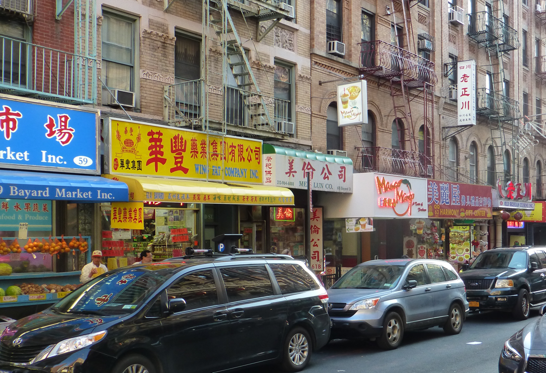
Chinatown is compact and easily walkable for grownups and kids. Canal Street is the main thoroughfare and was also traditionally the place to go for designer knockoffs of bags, watches, and clothing – this has become gradually less so each year, partly due to stricter enforcement, but more so to soaring rents: banks and restaurants are taking over spaces that used to be inexpensive hawker stalls.

More-interesting shopping for families can be found up and down Mulberry, Mort, and Elizabeth Streets for the block south of Canal – miniature shopping malls for clothing, anime and toys, and arts and crafts line the area. Stationers, home and kitchen-supply stores, electronics merchants, grocery stores, and serious art galleries are also abundant. Hunting this area could easily consume a couple hours.

Image by Marina on Flickr; CC 2.0 license

Image by Marina on Flickr; CC 2.0 license

Bounding these blocks to the southwest is Columbus Park; green space well-used and loved by local residents. Watch for people meditating and practicing tai chi; live music events are often held there.

Image by Dmitri Robert via Flickr; CC 2.0 license

Image by Dmitri Robert via Flickr; CC 2.0 license

The southeast corner of the neighborhood is Chatham Square, where Bowery, Worth, and East Broadway intersect – East Broadway is a “newer” part of Chinatown, where Fujianese have settled since the 1990s.  To the north, walk up Doyers Street for a “Diagon Alley”-feeling: this narrow, twisted lane holds many colorful shops.

Image by Henning Klokkeråsen via Flickr; CC 2.0 license

Image by Henning Klokkeråsen via Flickr; CC 2.0 license

At the intersection of Bowery and Canal is Confucius Plaza and the entrance to Manhattan Bridge.

Restaurants abound through the entire district; fast food and bubble-tea counters to casual eateries to high-end productions. Please don’t think with a family that you’ll have to settle for food-court fare or McDonald’s to eat affordably – it’s actually quite possible that the most reasonably-priced dining in all Manhattan can be found in Chinatown! For instance, I’ve had an amazing and satisfying meal at New York Noodletown; enough for leftovers; for well under $10. 

A few dining reference guides to check out include the New York Eater Chinatown newsfeed; this guide from Thrillist; and a concise listing from Grub Street.  Or you could just wander around and see which places are getting good foot traffic; that’s where you want to go.

Image by Monica Wong via Flickr; CC 2.0 license

Image by Monica Wong via Flickr; CC 2.0 license

The Museum of Chinese in America, (admission $10 adult/$5 for kids) on the north end of the neighborhood at 215 Centre Street, holds at least two rotating exhibits, offers educational and artistic activities for children, and also offers neighborhood tours (at extra charge). They also house a reconstructed general store and artifacts from old Chinatown.

Where family travelers can stay:

While there aren’t many family-compatible hotels in the neighborhood itself (the Best Western Bowery Hanbee, the Wyndham Garden Chinatown, and the independent Hotel Mulberry would be three to look at, plus the Sheraton Tribeca New York and the Hilton Garden Inn Tribeca are only a couple blocks west on Canal); the convenience of the subway network opens up other lodging options, such as in Lower Manhattan:

Holiday Inn Financial District (by the Rector Street station on the R train)

Holiday Inn Wall Street (Fulton Street station on the J and Z lines)

Residence Inn Downtown Manhattan (also the Fulton Street station)

On the East Side:

Holiday Inn – Lower East Side (Essex Street station on the J and Z)

And in Midtown:

Hyatt Union Square (at the Union Square station, with the 6 and R lines)

DoubleTree by Hilton Hotel Metropolitan (51st Street station on the 4 and 6)

Best Western Plus Hospitality House (also the 51st St. station)

Image by Erin Johnson via Flickr; CC 2.0 license

Image by Erin Johnson via Flickr; CC 2.0 license

What other family travel attractions are nearby?

At this point, Chinatown has virtually encapsulated Little Italy and it’s easy to walk right past it: the few blocks on Baxter and Mulberry between Canal on the south and Broome on the north still hold iconic restaurants and street scenes you’ll recognize from the movies.

Canal Street west of Chinatown is the Tribeca neighborhood, an easy walk, and a rich ground for visual art galleries and museums.

The Cortlandt Street and Fulton Street stations south of Chinatown are the closest to the World Trade Center and its memorial museum, Zuccotti Park of protest history, and Wall Street. The site of the Twin Towers is profoundly moving for those of us who were adults at 9/11, and truly a must-visit place for children on a trip to New York City: reading the names of the victims and the fallen rescuers, and seeing the faces of the families, friends, and citizens who have come to pay respect, make a powerful lesson about how deep America’s multicultural and multiracial identity has become, and that everyone has a place in this city and country.

See also:

Our Pinterest folder for New York City

And other interesting resources can be found at:

http://www.explorechinatown.com/ for news and events

https://www.walksofnewyork.com/blog/ny-chinatown

https://en.wikipedia.org/wiki/Chinatown,_Manhattan

Chicago - Chinatown

Click to open Google Maps

Click to open Google Maps

The neighborhood is quite distinct in the Census data. Click to open the fascinating University of Virginia Cooper Center map project to visualize ethnic patterns from the 2010 Census.

The neighborhood is quite distinct in the Census data. Click to open the fascinating University of Virginia Cooper Center map project to visualize ethnic patterns from the 2010 Census.

How to get there:

The Cermak-Chinatown stop on the CTA’s Red Line “L” train is just steps away from the traditional entrance gate, and less than 15 minutes’ ride south of the Loop.

By car, the Dan Ryan and Stevenson Expressways meet here. Cermak Road is the main access to the neighborhood; best to use the Wentworth Ave. parking lots and walk around as on-street parking can be scarce.

A brief history:

Chicago’s Chinatown was the second major center for Chinese migration in the U.S., after San Francisco. The Transcontinental Railroad which spurred so many laborers to emigrate was also the pathway out of an increasingly anti-Asian California of the 1860s-1870s.

Early arrivers built a small community inside the Loop, but in the 1910s, Chinese fraternal associations bought property and started construction in today’s location. Businesses, banks, and housing at affordable rates made it a natural choice for newcomers, as well as a “safe space” against racial discrimination and crime.

Investment and expansion continued through the 20th Century to keep this neighborhood vital and attractive to migrants from China in the post-“opening up” era of the 1980s-1990s.

What to see and do:

People from all over Chicagoland know this neighborhood has some of the best dining in the city, especially its Dim Sum options like at Phoenix, Cai, and Triple Crown. Eater has a wonderful map listing well over a dozen recently-reviewed restaurants.

Chinatown offers a number of events throughout the year, including of course a Lunar New Year parade and a Mid-Autumn celebration. Each weekend on Temple Street in Chinatown Square there is a street market offering gifts, produce, and prepared foods.

Chinatown Square itself, abutting Archer Avenue, is a newer two-story mall with a number of restaurants, groceries, clothing and gift shops. This area also includes the Chicago Chinese Cultural Institute, and just to the north, Ping Tom Memorial Park along the South Branch of the Chicago River. The park has walking paths, an activity center, kayaking, and even water shuttles during the summer.

Even more variety of shopping can be found along Wentworth Avenue, the heart of the old neighborhood. Bakeries, kitchen-supply shops, and antiques are all fascinating stops to make. You’ll also find the small Chinese-American Museum of Chicago at 23rd Street, a half-block west of Wentworth. At the southern end of the neighborhood along West 24th Place is tiny Sun Yat-Sen Park.

Where family travelers can stay:

There are dozens of great family-friendly hotels in Chicagoland, but for easy access to the Red Line (a connection at the State/Lake station will get you on the Blue Line to O’Hare Airport; or on the Orange Line to Midway Airport), some locations to consider in the downtown core include:

  • The Wit – a DoubleTree by Hilton, one block from the Lake station and just south of the Chicago River
  • Homewood Suites on West Grand Avenue – one block from the Grand station
  • Embassy Suites Chicago Downtown, on State Street between Ontario and Ohio – also one block from the Grand station
  • The Hampton Inn Chicago Downtown, on Illinois at Dearborn, two blocks from the Grand station
  • The Hilton Garden Inn Chicago Downtown, on Grand at State, directly above the Grand station
  • And the iconic Palmer House, on South State Street, at the Monroe station and one block from the Art Institute

What else:

One stop further south on the Red Line will get you to USCellular Field for a White Sox game. One stop further north is the Roosevelt station; on a pleasant day it offers a nice walk to Lakefront for the Field Museum and Shedd Aquarium.

North Michigan Avenue is justifiably famous for shopping, but when kids get tired of stores, views of the river and the lake at either end are great fun, the Art Institute of Chicago is always worthwhile, and a ride up to the top of the John Hancock Center in good weather is great entertainment. (Don’t forget a snack at Wow Bao at the street entrance of Water Tower Place!)

Millennium Park, including the Cloud Gate and the Crown Fountain, are tremendously popular with families because the attractions and artwork are just SO fun to interact with, there is plenty of space to roam in, and food stalls and trucks are handy. Even better, referring to the theme of this series, the park is a place where families and tourists from all over the city – and all over the world – are there to indulge their sense of wonder and play with each other in peace. You’ll hear dozens of languages, including a lot of Chinese, Korean, and Japanese …